Overview
The Howard County Office of Transportation conducted a planning study and preliminary design for a shared-use (pedestrian and bicycle) pathway along Robert Fulton Drive.
The goals of the project are:
- Improve bicycle and pedestrian access to Columbia Gateway from surrounding communities
- Improve bicycle and pedestrian access from Columbia Gateway to nearby "lunch hour" restaurants and retail destinations
- Seek to connect to nearby projects on Oakland Mills Road, McGaw Road, and Snowden River Parkway, as well as the Columbia pathway network.
Project Details
Planning Study
Final report. The final Planning Study for Robert Fulton Drive Shared-Use Path project was completed February 6, 2021.
Supporting documentation. Additional materials include the following:
Next steps. Final design is expected to be completed in 2025. Construction is not yet funded and is likely to require grant funds or developer contributions.
Public Meeting and Input
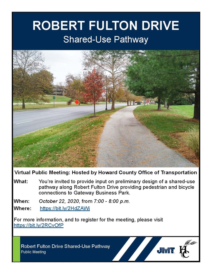
A public meeting was held virtually on Thursday, October 22, 2020 to share information on the proposed design and receive feedback from the community. Twenty-three members of the public attended.
- The video of the meeting can be seen here.
- The presentation alone can be accessed here.
- A summary of questions, comments, and responses can be found here.
- All comments on the proposed design received from the public by the November 5, 2020 deadline are have been being considered in the final design.
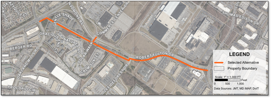
Proposed Design
Feasibility Study
The Office of Transportation held an open-house style community meeting on November 19, 2019 in the cafeteria of Guilford Elementary School to present concept options for public review and comment. Based on the comments heard at the public meeting on November 19th and received via email after the meeting, Howard County advanced Option 1D/2C to preliminary design. Click here to view those two concepts. Preliminary design included a field topographic survey and environmental assessment as the first phase.
Feasibility Study Area Options
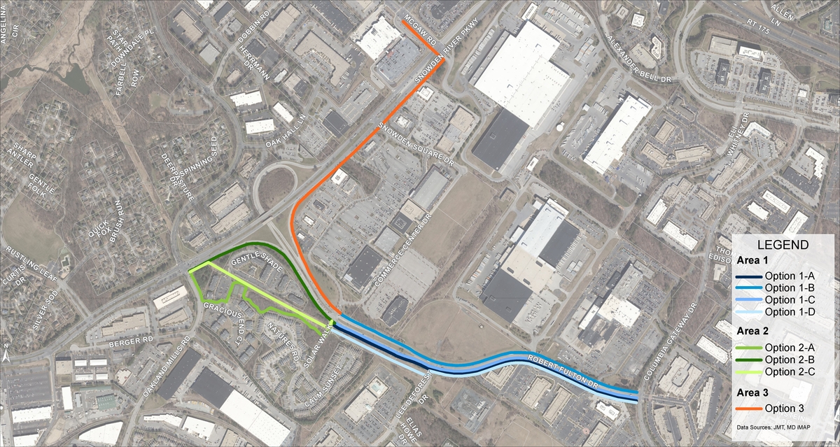
Initial Concepts
| Area | Description | Links |
|---|---|---|
| Area 1 | Columbia Gateway Drive to Solar Walk | |
| Area 2 | Solar Walk to Oakland Mills Road/Snowden River Parkway | |
| Area 3 | Solar Walk to Wegmans | |
| Areas 1-3 | Full Study Area |
Initial Study Process
This planning phase assessed multiple options across three areas within the broader study boundaries, as shown above. As pedestrian and bicycle access into Gateway can be provided via multiple projects in the future, the specific goals of this concept phase were to determine:
- Whether this design phase should pursue a connection to the bicycle and pedestrian network at the Snowden River Parkway/Oakland Mills Road intersection (Area 2) or at Wegmans (Area 3)
- Once that selection is made, which of the assessed options should be advanced to preliminary design.
Based on the comments heard at the public meeting on November 19, 2019 and received via email after the meeting, Howard County advanced Option 1D/2C to preliminary design. Click here to view those two concepts. Preliminary design includes a field topographic survey and environmental assessment as the first phase.
Sign Up and Questions
If you wish to be added to our Office of Transportation distribution list to be informed about future transportation related projects and events, please click here.