Online Feedback Survey
Public Meeting Materials
Public Meeting
A public meeting was held on Thursday, October 15 2026 to discuss concepts developed for the feasibility study. The public meeting was held at The Hawthorn Center in Hickory Ridge Village.
All presented materials and a public feedback survey are linked at the top of this this webpage. The public feedback survey will be open for responses until Friday, October 30, 2026.
Please subscribe to receive updates from the Office of Transportation on similar projects.
Project Overview
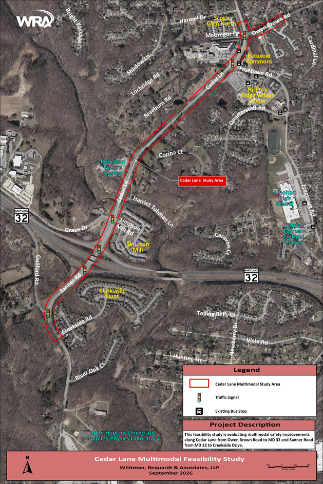
The Office of Transportation is conducting a study to evaluate the feasibility of providing pedestrian and bicycle facilities along Cedar Lane. The study area includes Cedar Lane from Owen Brown Road to MD-32, continuing along Sanner Road to Creekside Road. A study called the Hickory Ridge Bike Corridor was completed in 2020 to investigate multimodal connection opportunities between the Village of River Hill, Village of Hickory Ridge, and Downtown Columbia. This project is derived from some of the proposed improvements established in the 2020 corridor plan.
Project Details
The feasibility study includes the following measures:
- Gather and evaluate available existing information and data within the project limits. This will include GIS information, identification of major pedestrian/bike generators, field observations, roadway posted speed limits, roadway characteristics within the corridor, and any available crash data.
- Identify constraints and evaluate impacts of proposed concepts including drainage and SWM concerns, as well as potential environmental,
grading, right-of-way, and utility impacts. - Develop concept layouts for proposed pedestrian and bicycle facilities within the project limits.
- Host a public meeting to discuss the study and facilitate feedback from residents.
- Create a final report of the study, which will include a description of the existing corridor, critical elements/constraints within the corridor, and the proposed concepts.